Choosing a map for an adventure is easy right? The standard map for hiking for many years has been the Ordnance Survey 1:50000 set of waterproof laminated maps which retail for about €25. More recently, though the company has apparently been inexistance for over 30 years, EastWest mapping have produced €9.99 maps of specific areas of interest at a scale of 1:25000 and are water resistant. I am aware that the OS issue some 1:25000 maps but I don’t have one to compare with so here’s my thoughts on what map you should get out of the two I have.
Continue reading Choosing a map for your adventuresCategory Archives: SOTA
Slieve Carr
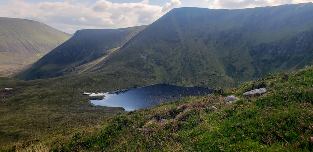
Ever since I first got interested in Summits On the Air, one mountain in the west of Ireland has been calling me. In the Nephin range in Co. Mayo lies Slieve Carr. At 721m it is not even in the top 40 highest mountains in Ireland, but as it is often referred to as ‘the most remote mountain in Ireland’ it had remained un activated.
Continue reading Slieve CarrSOTA promotional leaflet
‘Summits on the Air’ is a great way to operate an amateur radio station in a portable environment. In Ireland there are plenty of summits, of varying difficulty, to choose from. And you will nearly always manage to make contacts, especially if you can spot yourself on the sotawatch cluster, as people around the world really want to work you.
However, setting up a station, particularly for High Frequency, get’s you noticed. It can involve having a mast about 7m high and 20m of an inverted V dipole hanging from it! This invites attention from hillwalkers – especially if you fly a SOTA flag from the mast!

I’ve produced this leaflet to give out to such curious members of the public who come over for a chat. It’s mainly for Ireland but can easily be adapted for other counties and covers the basics of Summits On The Air.

Tonlagee SOTA activation
Another SOTA catchup post from last year!
For the 40m counties contest in May I decided to go up Tonlagee. There is a steep but short route up to it from the ESB car park and since the weather was nice I decided to stay overnight. Weather for the contest was good, but the propagation was terrible especially for a low power station, still an enjoyable afternoon up there chatting to people who came over.
What really makes camping in the wilds of Wicklow worthwhile, apart from the silence, darkness, remoteness, lack of people all night, general solitude (can you tell that I used to really enjoy heading to the hills for a few days?) – is the mornings. Here are some photos:
Continue reading Tonlagee SOTA activationFirst SOTA Activation on Lug
I did my first SOTA activation on Lug in September for the 2m/70cm IRTS contest. I won the 2m contest and did well in the 70cm considering I just had a Baofeng handheld.
However Lug is windy. It’s the highest summit in the East of Ireland and it was a particularly windy and occasionally wet day. So not the time to try and get a 10 element antenna working portable. After it blew down hard a couple of times, I settled for setting it up couple of meters above the ground and was only just about able to turn it in the wind. Worth experimenting with again, but in better weather.
Continue reading First SOTA Activation on LugTwo Rock Activation
It’s taken a while but I’ve finally managed to activate my nearest SOTA summit! Two Rock Mountain is the highest of the three SOTA summits in County Dublin, at only 536m. Nearby is Three Rock Mountain which has great views over Dublin City and a transmitter site near the summit transmits most FM radio and TV to Dublin. Continue reading Two Rock Activation
Kippure Summit Activation
Kippure is one of the more popular SOTA summits in Wicklow. Probably because it has a nice road going up to it! The gate at the main road is usually closed – access is only for crews working on the transmitters, but there is parking for a few cars at the gate. This being on one of the main roads from Dublin you should not leave valuables in your car – I’d even suggest removing the boot cover and leaving the glove box open as there have been a spate of car break in’s this summer in the hills.
Continue reading Kippure Summit Activation
Trooperstown SOTA Activation
Last Monday I had a meting at the Wicklow Mountains National Park office, and with Trooperstown so close I thought it would be a shame not to go up and do an activation. It’s a 4point summit, EI/IE-035.
Coillte provide a car park just before the bridge over the Inchavore River (T 160 970), but if you are feeling lazy you can drive up the forest road and park where the trail up Trooperstown starts (T 164 962). I found the forest road fine in my wifes Ford Fiesta, there is parking for a couple of small cars at the trailhead. Continue reading Trooperstown SOTA Activation
Corraun Hill SOTA Activation
While in Mayo last week I decided I’d take a few hours to try a SOTA activation. There are plenty of summits to choose from, 8 around Achill and another 25 between the Nephin range and Ceide Fields. Robert Lloyd Praeger in 1937 wrote that “the Nephinbeg range of mountains is I think the very loneliest place in this country” and so it’s no surprise that many of the SOTA summits here remain unactivated. Slieve Carr, the highest mountain in the Nephin range, is about 14km from the nearest road and is surrounded by bog. An activation would probably require an overnight camp, but you would be camping in Irelands first Dark Sky Park so the view of the un-light-polluted cosmos alone would be worth it. All that though is part of the allure of these mountains. If you do feel the call of wild Mayo and want some help or perhaps a guide, get in touch with the nice folks at www.terrafirmaireland.com.
Continue reading Corraun Hill SOTA Activation